Friday, 3 June 2016

2nd Monday – Straide, Islandeady, Westport, Croagh Patrick

Another lovely day – I wish I’d brought more t-shirts rather than warm tops, could even do with shorts today!

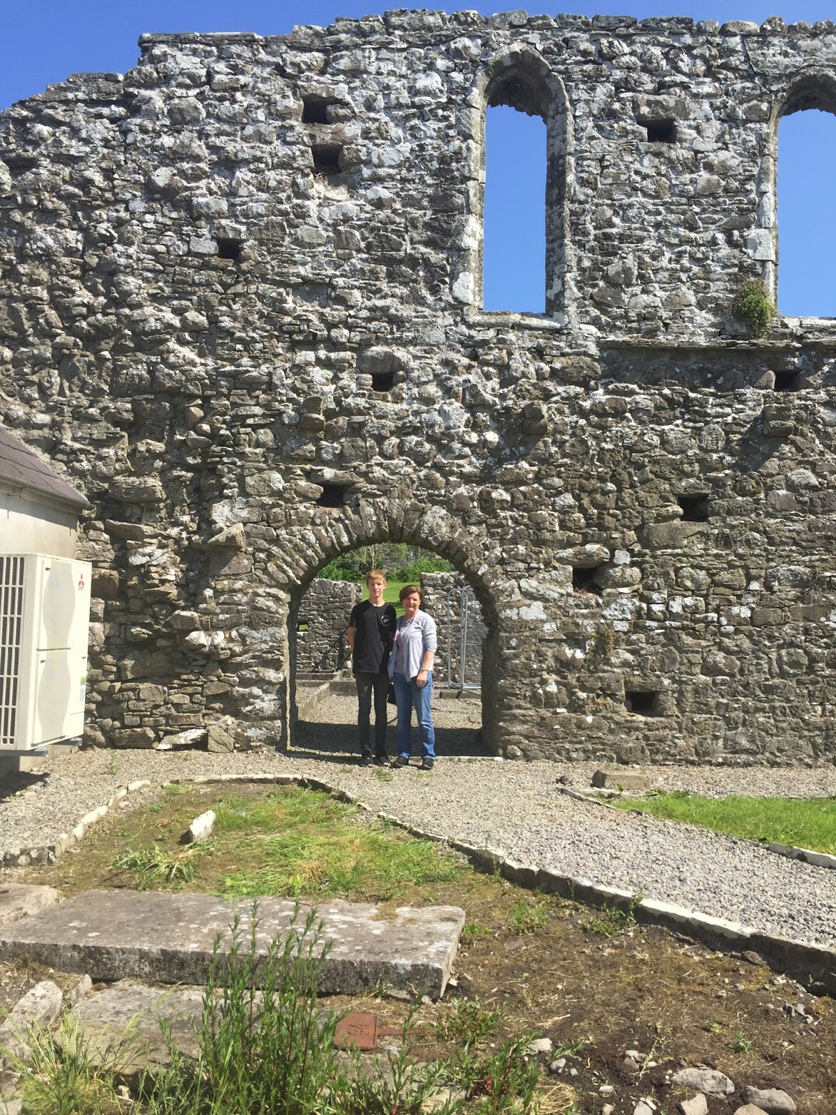
After a very nice breakfast at Doogarry House, our B&B just out of Castlebar town, it was off to Straide Abbey and the Michael Davitt museum to see great-great-great-granny Anne Bald’s grave. Big thanks to Yvonne and her ladies at the museum, who showed us to the grave (with a little help from the photo on burntisland.net), took photos of us there, and found the transcript of the epitaph. The grave itself just looks like a slab of stone now; you need to look from an angle even to see that there were once words on it, so it’s great that they captured most of it a few years ago (in a project to transcribe all the graves they could, before they deteriorated further).


We are pretty sure the transcription is not quite right: it says she died in 1825, but we know William married again in 1823, so it’s fairly safe to say Anne would have died before that. It also says she was 26 years old, which poses a bit of a mystery – we know she married William in 1810, so if she really was 26 it’s likely she died in 1820, which would make her 16 when she married…seems reasonable. But the bit that doesn’t add up in that case is William waiting 3 years before marrying again, which would seem unlikely for the time, when he had 3 young children to be cared for. My guess is that Anne died in 1822/23 aged 28.
I asked why Anne would have been buried at Straide Abbey, and the museum staff said she was most likely from the area. We spoke to the parish priest to see if the church still holds any records (e.g. births or marriages), but he said he has nothing, and to try the BMD registry in town. (Which I did, but they have nothing earlier than 1864, so that was a dead end for finding more about Anne.)

Then I tried to track down another priest, the one from Islandeady (“Eye-lin-aid-y” – I struggle to say that right, just can’t get the hang of a silent d!). This is because William and his 3rd wife Margaret McGreevy were married by the Islandeady P.P (in 1842), so I wanted to check whether this church has any records which might have any more snippets of information. The P.P. was out for the day, but I got his email address from a notice in the church foyer, so I’ll get in touch with him later.

Once my religious efforts had proved futile, we went off to Westport, a coastal town 20-odd km from Castlebar. We drove just beyond the town centre to the port, and to Westport House, the estate of the Marquess of Sligo (aka several generations of Mr Brownes). The house is open to the public, and they also have a whole lot of stuff going on around the estate, presumably to try to stay solvent (I gather the family has run out of money, and the house is on the market) – so there’s big plastic swan boat things in the pond, airsoft games in the woods, and go karts and ziplines and zorbing and all manner of semi-adventure activities available (a shame, really out of keeping with the grandness of the house). I’d read somewhere that Westport House had a partial print of one of William’s maps, so I asked the guy on the entry desk whether he was aware of any maps, but he wasn’t. We paid up to have a look around (actually, PR/Helpdesk guy was quite amused by Levi, so he let him in free), and began to wander round. The Browne family are descended from Grace (Grainne) O’Malley, a 16th century clan chieftain and shipping magnate (!), and Westport House is built on top of the ruins of one of her forts.
The house is quite magnificent...
 ...and the dungeons were pretty cool too!


The coolest thing though, was walking down a flight of stairs and sure enough coming upon a framed print… “Plate XIV MAP of the BOGS Lying in the South West part of the Count of MAYO, whose Waters discharge themselves into Clew Bay, Killery Harbour & Lough Mast with the Lines of Levels & Drains for the Commifsioners appointed to enquire into the Nature & Extent of the Bogs in IRELAND And the Practicability of Draining & Improving them BY WILLIAM BALD, ENGINEER. 1812.” Awesome!


We had lunch in Westport, a very pretty little town, then final stop for the day was at the foot of Croagh Patrick at Murrisk, another 8km on from Westport. Croagh Patrick is 762m barren, rocky hill, the climbing of which seems to be one of the principal tourist attractions in the Castlebar area. It’s a place of pilgrimage, as there’s a chapel at the summit – seems to me to be poorly placed, surely you’d have it at the bottom as a place of prayer that you’ll make it to the top! Our pilgrimage only went as far as the St Patrick statue just above the visitor centre, but even from just that elevation the views out over Clare and Achill Islands were fantastic.


Thursday, 2 June 2016

Sunday - Musical cheers

We woke to another brilliant, beautiful day and breakfast in the conservatory. Our hosts at Lillikoi B&B were a lovely couple, very well-travelled, and with some hilarious stories. If you’re ever in need of accommodation near Derry, I’d definitely recommend Lillikoi.

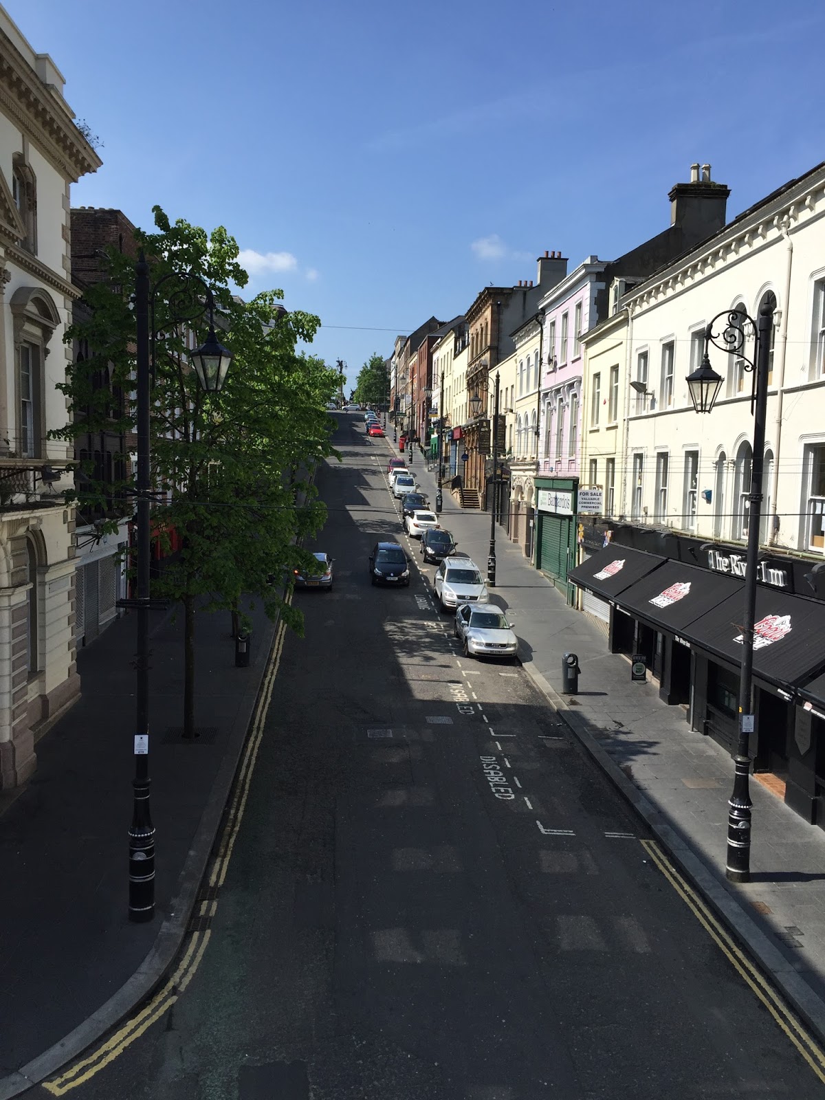
Before hitting the road to County Mayo we went for a look at the walled city of Derry (or, as the road signs all put it, in order to satisfy both unionists and nationalists, “Londonderry/Derry”). We parked on the east side and walked over the Peace Bridge, designed to be reminiscent of a handshake, with two large support/suspension pillars, one on each side on opposite angles but leaning towards each other. The bridge design is meaningful in the healing of the historical separation of Derry, whereby unionists/ Protestants moved to the east side of the river and nationalists/ Catholics stayed on the west side.

Adjacent to the city side of the Peace Bridge is the Guildhall, a stunning town hall building which now houses a very interesting museum about the Plantation of Ulster – that is, the plantation of people from England and Scotland to colonise northern Ireland. The stained glass windows in the Guildhall are a sight to behold.

 And I very much enjoyed the Scots Gaelic(?) signage.

Finally we went for a walk around the city walls, a stroll of about a mile with great views, helpful signage summarising the history – and cannons still sitting in their long-ago strategic positions.


Then it was off to Co. Mayo and William Bald’s musical bridge at Bellacorick. It was a pretty long drive, and the Irish roads live up to their reputation as being not very good – the best it got was one lane and a shoulder in each direction, with a very occasional passing lane. Some of the very small villages had a set of traffic lights – at one place, for no apparent reason we had to stop and wait for at least two minutes… while nothing happened – there were no vehicles needing to cross or turn into the “main” (I use that term loosely) road. However the trip was redeemed by the scenery – most of the way was through quintessential Irish lush rolling countryside; plus now we’re in the Republic we are in km/h territory (to match the car), rather than mph as in Northern Ireland. (Not that I’m quite sure most of the time what the actual speed limit is… I figure the approach “go with the flow” should see me right.)

Once in Co. Mayo we went through some towns whose names have become familiar through the history research: Ballina ("Bell-in-aah", where we spotted Barret Street, perhaps named for Dr Barret, father of William's second wife Matilda?), and Crossmolina ("Cross-ma-line-a", a cute wee place), and finally to Bellacorick. The Bellacorick bridge is a low, multi-arched stone bridge that crosses a stream at a crossroads, by a now-defunct pub. The idea with the bridge is that you run a stone along the capping stones, and it makes “music”. Now don’t go thinking melody or scale or tuneful music of any sort – but the capping stones have clearly different tones, and some of them when struck ring and resonate as if they’re made of steel. One of the things that’s really neat about the bridge is how obvious it is that people have been playing there for many, many years: on both sides of the bridge, the surface of the capping stones on the side nearest the road is worn smooth, while on the outer areas the surface is still rough. (One of the things that’s not really neat about the bridge is that there’s no footpath, so playing has to be interrupted every time a car goes past, as you flatten yourself against the side wall for the sake of safety!)


Once we were done there we drove down through the bogs area to Castlebar, home of William Bald and his family from 1809 until 1820-something. One of the projects William did in that time was to map and report on the bogs (I’ve got a pic of one of the maps as my Facebook cover page now). It must have been pretty difficult work in some parts, as the land was rough and there were (and are) few roads or inhabitants. The landscape going into Bellacorick and the first part of the road from Bellacorick to Castlebar is quite different from what we saw earlier in the day. It’s brown and scrubby rather than green, and there are big, rounded, barren-looking hills in the middle distance. The road reminded me of (a much longer version of) Collins Road near Hamilton, which undulates (bumps its way) across the peat swamp.

Monday, 30 May 2016

Saturday – Antrim Coast Road and more

Brace yourself – this was a BIG day!

Today we started on the Ireland leg of our road trip. After breakfast and checking out of the hotel, we went to the airport to pick up our rental car. We’ve got a Hyundai IX35 manual diesel, which is a bit of a beast – not quite the compact vehicle I’m sure I ordered! But it’s fine, pretty comfortable and easy to drive. (Something I haven’t seen before – in the middle of the fuel gauge a number sometimes appears – at first I thought it was how many kilometres we’d travelled, but after we’d been a few km and it still lit up ‘3’ it became clear it wasn’t that. Turns out it’s helping you choose when to change gear, telling you what gear you should change up or down into. Cute.)

First stop on the drive was at the Antrim Coast Road / William Bald commemoration plaque at Larne. As soon as we got there I FaceTimed Dad so he could see me and Levi at the site, which was pretty cool.

Next stop was Baldy’s Branch at Carnlough – we went to the corner that Dad had identified on the little road that runs parallel to the Coast Road north of the town. We pulled up outside a house (Rose Cottage) right on the corner, and there were people sitting outside so I went to say hi – since it seemed a bit weird to just stop on their little country road and start taking photos. When I asked “is this corner known as Baldy’s Corner?” the woman said no, this short piece of road from the corner down to the coast road is known as Baldy’s Branch. She said there’s 2 stories about where the name came from – one about a bald man who used to live nearby, and the other about the man who built the coast road (Archibald?? Oh yes, William Bald); this little stretch of Largy Road was a branch built from the old road down to the new coast road, “Baldy’s road” – so this became Baldy’s Branch. She thinks the second one is the real story, though. So do I J

The drive up the coast road seemed more stunning today – the weather was better for a start, and perhaps I was a bit more relaxed with a few nights of proper sleep… not to mention no cameras! Every headland you drive round seems to open up into a bay with another village more picturesque than the last, each of them with lush, beautiful farmland sloping up the sides of the glens. The shapes of the headlands and the long-distance views are spectacular – and it was clear enough to see Scotland in the distance, the Ayrshire coast at the beginning, and the Kintyre peninsula once we were further north.
 

Once you get past Glenariff and Waterfoot, through the red arch, the road drives up and away from the coast. It comes out into completely different countryside, the tops of the hills which are much browner and vast, with no sense of cosiness like the bottom of the glens. It reminded me a lot of the first part of the Taupo-Napier road.

One of the next sights on my list was the Glendun viaduct. As you drive along the road it looks like not much, just a small, low bridge with a little signpost that you’d blink and miss – and we missed. Right after that we turned off the main road and drove down to Cushendun, which is another gorgeous little seaside village, very much off the beaten track. We had lunch in an old pub there, which was all very period…but there was still an old gal playing a pokie machine out the back. Some things are the same everywhere, huh? Anyway, after lunch we went back up to the main road, looping round so that we could have another pass over the Glendun viaduct, now knowing where it was and being able to take a (from-the-moving-car) photo opportunity.

The next stop was a highlight – Coretavey Bridge, which is pictured on the Bald page on the Burntisland website. Again the bridge doesn’t look like much as you drive over it… except it has “Coretavey, William Bald Engineer” engraved into stones half way across it. Levi and I risked life and limb and several passing cars to get photos, and to fill in the lettering with chalk (brought all the way from NZ for the purpose!). So for the next few days (hours? Until it rains next) passers-by will be more likely to notice William, as he’s coloured bright blue. Once we’d done that Levi convinced me to clamber down the grassy bank beside the bridge (Levi called it a path, but that was a stretch!) to the combined road/stream crossing below. From that angle, the bridge was spectacular – very tall, with a beautifully formed stone arch. We went under the bridge to the other side, and found the plaque attached to the side of the bridge: “This bridge was built by William Bald in 1834 to carry the road which replaced the old Irish Highway from Cushendall to Ballycastle.” I added my own blue-chalked name/date “plaque” on the side wall of the arch under the bridge.


Then we were on to the more widely known tourist attractions on the Antrim coast. First was Carrick-a-Rede rope bridge, an old, 20m long suspension footbridge over a 30m drop to the sea, to a small island with nothing but seabirds and great views… and queues L Despite my qualms about heights (I did this for you, Levi!) I did make it over the bridge (and back again). Levi freaked me out on the island wanting to go near the cliffs though (near = within 10 metres), and I really couldn’t handle it! We were told later that sometimes people get stuck on the island, if the wind comes up they can’t come back across the bridge – yikes! Spectacular cliffs, seabirds nesting, crystal water.
  

Next was the Giant’s Causeway, a beach area of hexagonal-shaped rocks, formed by ancient volcanic activity, that look like a giant crystalline structure. Think of a honeycomb staircase where each honey cavity is a rock. The landscape is really alien, it looks so unnatural and architectural.
Levi freaked me out again going up on the high rocks, with a many-metres sheer drop over the side. It was very cool, though, quite magical.

We made a brief stop at Ballintoy Harbour, a tiny wee harbour very recognisable as a Game of Thrones set (Iron Islands harbour, I think). There were lots of people there; I’m sure its tourist numbers have increased a hundred-fold since it featured on GoT.

From there we drove to Dunluce Castle, the ruins of a castle sitting up high overlooking the sea. We came around a corner and literally went “wow” – pillars and broken walls of old rock pointing aloft, silhouetted against the early evening sky. We found out later that it was inhabited up until the 16th century – at which time, during a party, the kitchen and its staff all fell into the sea, so the residents upped sticks and left (as would be advisable, I guess!).

Last stop was the Dark Hedges, a km or so stretch of road which was planted many years ago on both sides to form an avenue of trees, which are now all gnarled and twisted. It’s long been a Northern Ireland tourist attraction, but has gained extra appeal since featuring in an episode of GoT. As we drove along I felt it was a bit underwhelming – too many cars really spoil the effect of the old gnarly trees – but it turns out the photos look great (good work, Levi).


We finally got to our (fabulous) B&B near Derry at 9pm. At 9.45 we were sitting in the conservatory eating our takeaway dinner and admiring the gorgeous views out to the sea and the peninsula, with the light of late afternoon. Can’t get used to these long daylight hours!

Friday – more sweet R&R

To add to our count of modes of transport (to date: plane, walk, travelator, train, taxi (modern), taxi (London), common-or-garden car, and boat), today we took a Belfast public bus (they are pink!).
Aunt Sandra’s Candy store (which is also pink) is in a shabby little row of shops along Castlereagh Rd a couple of kilometres east of the central city. It turns out it’s not much like Candyland – it’s two small shops joined together, with a candy store in one and they put on a Willy Wonka-styled show in the other. To give him his credit, the guy who does the show is very good – dressed up in a waistcoat and big silly hat, telling yarns and making various shaped lollipops that become quiz prizes – but it’s aimed at younger kids than mine. (Having said that, Levi is as big a sugar fiend as any, so he was happy to sit through it and answer a quiz question to get rewarded with half a cup of molten sugar set in the shape of an Oompa Loompa’s foot – pink, of course!)

After the candy show we wandered back down the road to the bus stop, and noticed a big UFF mural at a corner on the end of a row of shops. This wasn’t in a “Troubles tour” area, but obviously just another of the squares in the political checkerboard that is Belfast.

It was a lovely day today, much milder than yesterday, still chilly but not bitterly cold so it was quite pleasant to be out. When we got off the bus back in the central city it was really busy, people everywhere. There was a fair of some sort in the grounds of the City Hall, mostly food and craft stalls. I’m not sure if it was a normal Friday, or busier than usual because of the mid-term Bank Holiday weekend, but one way or another the city centre was humming.


Our other big outing of the day was to the laundromat to catch up on a bit of washing. It turned out to be very interesting: I got talking with the proprietor and another customer, first about the reason for our trip (the guy was sure he’d read of William Bald somewhere), and then on to the Black Taxi tour and what it’s like to live in Belfast. It was fascinating to get an insight into their views, as Joe and Josephine Bloggs citizens of Belfast (both aged in their 40s I’d say). Both were Protestants, but he’d grown up in a Catholic area, and said that he actually thinks the Catholics are on the side of right as they were the oppressed ones. I was a bit surprised that he espoused that view out loud, and asked is he mindful of what he says depending on what company he’s in? He had to think about it a bit, then said yes he guessed so, but seemed not to have really considered it; then later on, he started another sentence with “Not that I’d say it to some people… oh! Yes, obviously I do mind my p’s and q’s!” (It was that he finds the Orange bonfires etc quite distasteful, as an overt display of dominance and implied threat.) The woman was very moderate too, remembers what it was like as a child in the 70s, and said she’s very pleased her own daughter has been brought up with integrated schooling. (Unlike herself, who didn’t know any Catholics until she was an adult and started working in the city.) Both of them thought the peace/ceasefire is secure, as the vast majority of people have no appetite to go back to how things were (“oh we just couldn’t go back”). You’d have not been able to get into the street the laundromat is in, because all through the central city there were gates closed at night to protect the shopping areas from bombs being planted. An army / police officer travelled on every bus, walking up and down and checking some people’s bags. They recalled being patted down at the barriers, and the huge amount of security to get through to reach the airport to go on holiday. There was general agreement that taking people as individuals, rather than seeing everyone just as part of a group identity (a “them”) is what builds and maintains tolerance. (Notwithstanding that, they still both found it worthy of comment – and with a slight air of pride, from which I inferred it’s not entirely common – that “I have both Catholic and Protestant friends”, “My daughter has Catholic friends as well, some of them are even better friends than the Protestant ones”.)

Thursday – enough R&R to sink a ship

Today, after a sleep-in and a late breakfast, we walked up to the Titanic Quarter to go to the Titanic museum. After the lovely weather we’ve had in the last couple of days, today was a bit of a shock – the high was about 11 degrees L As the day wore on it got more overcast, cloud came down over the tops of the surrounding hills, and there was a bit of chilly rain. Apparently such a day is quite normal for this time of year – spring going into summer! Brrr!

The Titanic Museum is in a magnificent purpose-built building reminiscent of a ship-shape. The exhibits are set over 4 or 5 floors, through a one-way system so that you see everything in the correct chronological order (it just wouldn’t work to see, for example, the debris exploration bits before the ship-building or –sinking bits). It starts from the context of Belfast society and industry, moves on to the construction of the Titanic and its sister ships, through the fit-out with examples of the 1st, 2nd and 3rd class quarters, the passengers, the sinking, and finally the exploration of the debris field. The way the information is exhibited is varied, and many of the exhibits are interactive or immersive. The highlights for me were a cable car ride through the innards of the under-construction ship, narrated by some of the different worker roles, and complete with breezes, heat and smells; and a cinematic simulation traversing the fitted out ship from bottom to top (I’m not quite sure how to describe this, but the audience stood in the middle of a continuous 3D-ish image spanning screens on three sides, and you’d swear the floor was moving rather than the image moving around you).

Once we’d finished with the Titanic we went out to its tender, the Nomadic (the smaller boat which took passengers out to Titanic in Cherbourg, as the harbour was too shallow for the big ship), which has been restored and is displayed in a dry dock just along from the museum. The Nomadic is interesting for having some original features that were the same as the Titanic, as the boats were built side by side; and for having a long history of service as a troop ship in the wars as well as having been a commercial boat.

James, you’ll be pleased to know I exceeded 10,000 steps again today on my Fitbit – but this time they’re legit, not the result of a 36-hour day or a bumpy boat ride J We were going to cycle back from the Titanic museum, but unfortunately the kiosk for Belfast’s public-hire bikes wouldn’t register us properly, so we ended up walking (probably a better idea, as the chill factor would have been way worse at higher speed!).


Tomorrow we’re off to Aunt Sandra’s Candy Store show – I expect something like Candyland at Taupiri – and then we’ll be packing up ready to start the Irish leg of our road trip on Saturday.

Thursday, 26 May 2016

Wednesday – Off to Scotland… for the day

Hooray! Slept through the night J

So today, we hopped on a little boat and went overseas! It felt odd enough yesterday to be able to see Scotland – seeing another country from the shore, definitely out of the ordinary for Kiwis. But to jump into a (really very) small boat to actually go to another country was quite unreal!

We drove from Belfast up to Ballycastle on the north Antrim coast, another really pretty seaside town (and apparently voted the happiest town in the UK). Although it was a beautiful day it was VERY cold on the boat, and quite choppy, so after the first 15 minutes or so we all – producer, director, cameraman, sound guy, Levi and me – ended up huddling in the cabin to avoid the wind and the spray. It took an hour or so to get to Port Ellen, a picturesque village built around the harbour and one of several towns on the island of Islay (“Eye-la”). The island population is about 3 ½ thousand – and it’s home to 8 distilleries, including Ardbeg and Bowmore as well as the famous Laphroaig.

Once we arrived, to warm up we popped into a café for tea and scones (in preference to a single malt!), and then we made our way to Dr Margaret Storrie’s house a mile or so up the road. Margaret’s house is on a section facing the sea, with lovely gardens both front and back. She was disappointed the gardens weren’t in full spring flower, but they were beautifully planted and well-kept nonetheless. The view from Margaret’s lounge and back garden is out to Rathlin Island and the North Antrim coast behind it, over to the left you can see the Kintyre Peninsula (of ‘Mull of Kintyre’ musical fame), and in between you’re looking straight down the North Channel, the strait between Scotland and Ireland which links the Irish Sea and the Atlantic Ocean. Stunning on a beautiful day as we had, and I can imagine stunning also, in a different way, on a wild winter day.

It was quite overwhelming to meet Margaret. William Bald first came to her attention when she was a young academic geographer and she came across one of his early maps, from the first decade of the 1800s when he was still a teenager. She was struck by the quality and detail of his work, and decided “I need to find out about this William Bald”. Her research uncovered that he’d moved on from surveying and cartography, and become a Civil Engineer undertaking many and varied projects, with the Antrim Coast Road being considered his greatest lasting achievement, the masterpiece of his engineering career. When in the early 2000s my dad started to look into the veracity of the story his father had told him, that an un-named grandfather had built the Antrim Coast Road, it was a reference to Margaret’s 1968 paper that proved the story was worth following up. So for me today meeting Margaret, who has been interested in William Bald for such a long time – before Dad really knew of William, before we knew he was “ours”, since before I was even born – was actually quite emotional.

We spent some time talking, more or less chatting, on camera in Margaret’s lounge. One of the most striking things was the level of effort she’d had to put into the William Bald research. This was in the 1960s, all the records were paper-based (oh we’ve got it so easy now with the internet!), and there weren’t even photocopiers – so she had her husband, mother, sister all helping her transcribe records and notes. In an attempt to trace descendants, she wrote to every Bald in the UK phone book, but to no avail – a few rellies-by-marriage, but no-one as directly descended as us Balds and Goodwins.

After the main conversation we walked up and down the garden a bit for the camera, still chatting but just for us, not being recorded; plus did the requisite listening shots, and Margaret describing the fabulous view to me filmed from 3 or 4 different angles. Gavin (director) interviewed me a bit more, and also Levi, about what we’d learned and how we’re feeling about William and his work and the experience we’re having. (It’s remarkable how quickly you can get used to wearing a microphone and having a TV camera on you.) Once Gavin was happy he’d got everything he wanted for the documentary we went back to the Sea Salt Café for lunch, then it was photos and farewells before we got back on the boat for the return journey to Northern Ireland.


The highlight of the return trip (cold again, but not so bumpy) was the skipper taking us in close to the northern side of Rathlin Island to see the birds – lots of them, floating in the sea, flying around, and roosting on the cliffs. I’m sure guillemots and razorbills are quite extraordinary, but what seemed the most exotic and exciting to me was to see puffins!

Tuesday – Filming with Paper Owl for the Antrim Coast Road documentary

It turns out 4.45am wasn’t so bad. Today Levi – and therefore I – woke up at 20 past 3. (It was impossible to keep Levi awake beyond about 7pm last night, so little wonder – and as I write this, 6.45pm Tuesday, he’s already asleep. I am shaking in my shoes L)

So today was our first day of filming. What a weird experience! We and our empty suitcases got picked up at 7.45 and taken to the airport. At the airport we met the director, Gavin, while the sound and camera guys (Michael and Seamus respectively) got set up. Then we had to channel Sunday night, walking from the arrivals door across to the airport exit as if we’d just arrived. We did a couple of takes of that, trying to look nonchalant as the camera guy came round in front of us and pointed the lens in our face – it’s so hard not to look at what’s happening, as if this is some sort of everyday occurrence! Really quite surreal!

Then we drove up to Larne, and parked at a service station just before the beginning of the Coast Road, so the guys could get set up. Microphone wires/kits for me and Levi, and 2 cameras in the car: one facing me and the other attached to a rear headrest looking out the windscreen. Then the director hunkered down in the back seat with a blanket over him to hide him from the camera, and with me now driving we started on our way up the Antrim Coast Road. The idea was to get our reactions as we saw the road and the coast for the first time – it’s known as one of the most beautiful scenic routes in the world. I hope the initial impact wasn’t lost, as unfortunately it was very foggy – the road itself was fine, but out to sea and in the forward distance it was just fog.

Happily, it cleared up beautifully later, and it was lovely. At various parts of the day we drove the southern (and properly coastal) part of the Coast Road, which links the southern and middle glens (of the 9 Glens of Antrim – where a glen is a U-shaped valley opening to the sea, formed in the ice age). Glenarm is a gorgeous wee town, and Carnlough looks like a jigsaw puzzle picture from across the bay! Initially we drove up to just before Carnlough, and then later in the day we went up as far as the Red Arch at Waterfoot/Glenariff - a very unusual shaped arch, parabolic rather than inverted U, and which doesn't look like it really needs to be there.

After Carnlough we went on to the old, inland road, and met up with a local amateur historian who was interviewed separately the other day. We talked about why the coast road was needed, and what a feat it was to design and build. This bit of filming was done by Pathfoot, a (now derelict) property at the bottom of the steepest bit of the old road, where the family made a living by hiring out extra horses to help carts up and down the hill. And it is steep! I twigged during this chat that the design/planning of the coast road must have been done from the sea, as there was just no access by land to some of the bits, especially the headlands.

After lunch (at the Londonderry Arms hotel in Carnlough, which was owned for a time by Winston Churchill http://www.glensofantrim.com/our_history.html) we met David Orr (former president of the Institution of Civil Engineers, and who used to be the engineer responsible for the maintenance of the Coast Rd). I'm not sure who was most excited to meet who :-) We went to a headland just south of Glenarm where there's a pile of big limestone rocks on the seaward side of the road, and talked about William's "big idea" of blasting the rocks to form the road, and again about what a feat of engineering it was. Then they had a photographer take some still pics of him, me, us together, and me and Levi - "for the press", apparently!

The whole filming process is fascinating. The driving bit involved trying to chat naturally to Levi about what we were seeing (fog L), as if there was no camera (or director crouched in the back seat!). In the interview-y parts (which were natural-ish conversations, rather than Q&A interviews), each time they'd follow that by doing a few long shots while we just chatted, and at one point we had to do listening shots, haha! When I was talking to David Orr we had to pause quite often while buses or noisy motorbikes went past, and the director would ask us to repeat or start a sentence over again to get the flow going again. A few people going past tooted their horns - most annoying to the production crew! And then at the end Levi and I had to drive up and down the stretch of road a couple of times so they could get footage of us going past in the car. Just weird, funny experience :-)


Levi really enjoyed the day, but boy we're both tired. Levi has been asleep for a couple of hours now, I woke him up long enough to get a bit of food and half a sleeping pill into him, so I desperately hope he sleeps beyond 4am tomorrow. I'm buggered! Tomorrow we're being picked up at 8 to go up to the north coast and hop on a boat across to Islay to meet Dr Margaret Storrie, a geographer who researched and wrote academic papers on WIlliam in the 1960s. Can't wait! But now I'm off to bed, maximise my sleep in case Levi does wake super-early again.