Another lovely day – I wish I’d brought more t-shirts rather
than warm tops, could even do with shorts today!
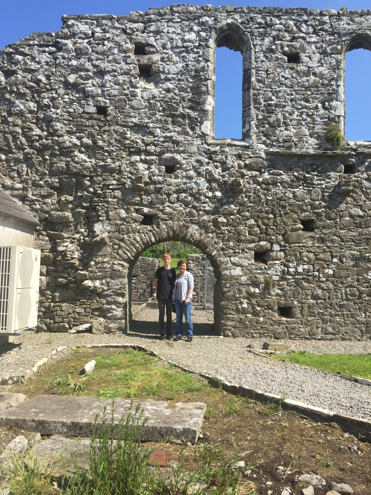
After a very nice breakfast at Doogarry House, our B&B
just out of Castlebar town, it was off to Straide Abbey and the Michael Davitt
museum to see great-great-great-granny Anne Bald’s grave. Big thanks to Yvonne
and her ladies at the museum, who showed us to the grave (with a little help
from the photo on burntisland.net), took photos of us there, and found the
transcript of the epitaph. The grave itself just looks like a slab of stone
now; you need to look from an angle even to see that there were once words on
it, so it’s great that they captured most of it a few years ago (in a project
to transcribe all the graves they could, before they deteriorated further).


 We are pretty sure the transcription is not quite right: it
says she died in 1825, but we know William married again in 1823, so it’s fairly
safe to say Anne would have died before that. It also says she was 26 years
old, which poses a bit of a mystery – we know she married William in 1810, so if
she really was 26 it’s likely she died in 1820, which would make her 16 when
she married…seems reasonable. But the bit that doesn’t add up in that case is William
waiting 3 years before marrying again, which would seem unlikely for the time,
when he had 3 young children to be cared for. My guess is that Anne died in
1822/23 aged 28.
We are pretty sure the transcription is not quite right: it
says she died in 1825, but we know William married again in 1823, so it’s fairly
safe to say Anne would have died before that. It also says she was 26 years
old, which poses a bit of a mystery – we know she married William in 1810, so if
she really was 26 it’s likely she died in 1820, which would make her 16 when
she married…seems reasonable. But the bit that doesn’t add up in that case is William
waiting 3 years before marrying again, which would seem unlikely for the time,
when he had 3 young children to be cared for. My guess is that Anne died in
1822/23 aged 28.
I asked why Anne would have been buried at Straide Abbey,
and the museum staff said she was most likely from the area. We spoke to the
parish priest to see if the church still holds any records (e.g. births or
marriages), but he said he has nothing, and to try the BMD registry in town.
(Which I did, but they have nothing earlier than 1864, so that was a dead end
for finding more about Anne.)
Then I tried to track down another priest, the one from
Islandeady (“Eye-lin-aid-y” – I struggle to say that right, just can’t get the
hang of a silent d!). This is because William and his 3rd wife
Margaret McGreevy were married by the Islandeady P.P (in 1842), so I wanted to
check whether this church has any records which might have any more snippets of
information. The P.P. was out for the day, but I got his email address from a
notice in the church foyer, so I’ll get in touch with him later.
Once my religious efforts had proved futile, we went off to
Westport, a coastal town 20-odd km from Castlebar. We drove just beyond the
town centre to the port, and to Westport House, the estate of the Marquess of
Sligo (aka several generations of Mr Brownes). The house is open to the public,
and they also have a whole lot of stuff going on around the estate, presumably
to try to stay solvent (I gather the family has run out of money, and the house
is on the market) – so there’s big plastic swan boat things in the pond, airsoft
games in the woods, and go karts and ziplines and zorbing and all manner of semi-adventure
activities available (a shame, really out of keeping with the grandness of the
house). I’d read somewhere that Westport House had a partial print of one of
William’s maps, so I asked the guy on the entry desk whether he was aware of
any maps, but he wasn’t. We paid up to have a look around (actually,
PR/Helpdesk guy was quite amused by Levi, so he let him in free), and began to
wander round. The Browne family are descended from Grace (Grainne) O’Malley, a 16th
century clan chieftain and shipping magnate (!), and Westport House is built on
top of the ruins of one of her forts.


The house is quite magnificent...
...and the
dungeons were pretty cool too!


The coolest thing though, was walking down a flight of
stairs and sure enough coming upon a framed print… “Plate XIV MAP of the BOGS
Lying in the South West part of the Count of MAYO, whose Waters discharge
themselves into Clew Bay, Killery Harbour & Lough Mast with the Lines of
Levels & Drains for the Commifsioners appointed to enquire into the Nature
& Extent of the Bogs in IRELAND And the Practicability of Draining &
Improving them BY WILLIAM BALD, ENGINEER. 1812.” Awesome!

 We had lunch in Westport, a very pretty little town, then final stop for the day was at the foot of Croagh Patrick at
Murrisk, another 8km on from Westport. Croagh Patrick is 762m barren, rocky
hill, the climbing of which seems to be one of the principal tourist attractions
in the Castlebar area. It’s a place of pilgrimage, as there’s a chapel at the
summit – seems to me to be poorly placed, surely you’d have it at the bottom as
a place of prayer that you’ll make it to the top! Our pilgrimage only went as
far as the St Patrick statue just above the visitor centre, but even from just
that elevation the views out over Clare and Achill Islands were fantastic.
We had lunch in Westport, a very pretty little town, then final stop for the day was at the foot of Croagh Patrick at
Murrisk, another 8km on from Westport. Croagh Patrick is 762m barren, rocky
hill, the climbing of which seems to be one of the principal tourist attractions
in the Castlebar area. It’s a place of pilgrimage, as there’s a chapel at the
summit – seems to me to be poorly placed, surely you’d have it at the bottom as
a place of prayer that you’ll make it to the top! Our pilgrimage only went as
far as the St Patrick statue just above the visitor centre, but even from just
that elevation the views out over Clare and Achill Islands were fantastic.
No comments:
Post a Comment